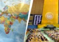




For more than four centuries, much of the world has become accustomed to seeing the planet through a particular cartographic lens. The familiar rectangular world map, found in classrooms, atlases, newspapers and digital platforms, is based largely on the Mercator projection developed by Gerardus Mercator in 1569. It was an extraordinary technical achievement for its time. By preserving direction, it made maritime navigation. It was an extraordinary technical achievement for its time. By preserving direction, it made maritime navigation considerably easier and became indispensable to sailors and navigators.
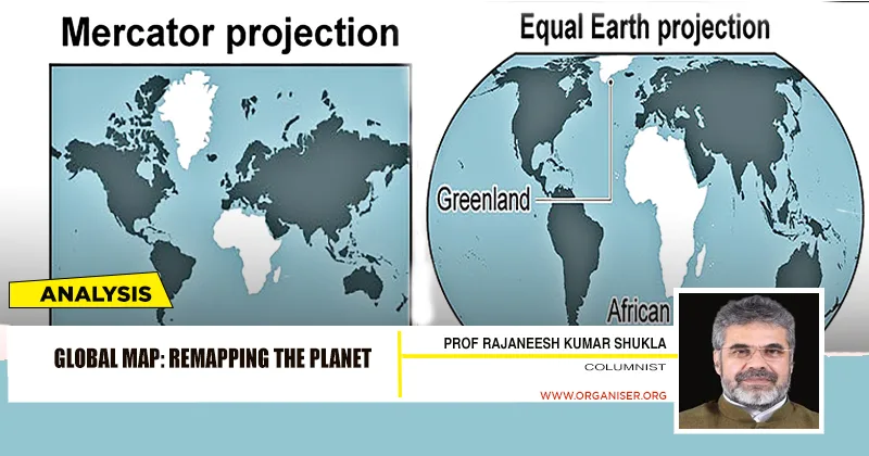
However, the very feature that made the projection useful for navigation also produced a significant distortion: it enlarged regions closer to the poles while reducing the apparent size of regions near the equator. The consequences of this distortion are not merely technical. Maps shape perception. They influence the way societies imagine space, power, centrality and importance. On the Mercator projection, Northern countries and territories often appear substantially larger than they actually are, while Africa, South Asia and much of Latin America appear comparatively smaller. Africa, for example, is roughly fourteen times larger than Greenland, although conventional Mercator maps can make the two appear broadly comparable in size.
Correcting the Imbalance
On September 4, 2026, the United Nations General Assembly addressed this long-standing problem by adopting the resolution “Correct the Map: Rebalancing Global Cartographic Representation and Promoting Equitable Representation of the World’s Regions, Particularly Africa.” Togo introduced the resolution on behalf of the African Group, and it received overwhelming support: 164 countries voted in favour, six abstained, and the United States was the only country to vote against it. The resolution is not legally binding, nor does it prohibit the continued use of the Mercator projection. Instead, it encourages Governments, educational institutions, international organisations, publishers and technology companies to consider equal-area projections, particularly where the comparative size of landmasses is important.
India’s support for a more equitable cartographic representation of the world carries symbolic significance. A multipolar international order requires more than changes in diplomatic language. It also requires a reconsideration of the intellectual frameworks through which the world has traditionally been described
The Equal Earth projection has emerged as a principal alternative in this discussion. Unlike Mercator, it seeks to preserve the relative area of continents and countries more faithfully. This does not mean that Equal Earth eliminates every difficulty associated with representing a spherical planet on a flat surface. No flat map can simultaneously preserve area, shape, distance, and direction perfectly. Every projection involves a compromise. The question, therefore, is not whether one map can provide an absolutely perfect image of the Earth, but which form of representation is most appropriate for a particular purpose.
Mercator Vs “Correct the Map”
For navigation, Mercator continues to have practical value. For education and global representation, however, its distortions raise more serious questions. The debate surrounding the “Correct the Map” initiative is therefore not simply about cartographic technique. It concerns the relationship between representation and power. African states and many supporters of the Global South have argued that the systematic visual minimization of certain regions has contributed to a wider historical imbalance in how the world is imagined.
Relevance of Cognitive Justice
This is where the language of Cognitive Justice becomes important. Political and cultural inequalities are not sustained only through institutions, economics, or military power. They may also be reinforced through systems of knowledge and representation. Maps are among the earliest instruments through which children learn to visualise the world. A representation that consistently places some regions at the centre while diminishing the apparent scale of others can influence collective assumptions, even when those assumptions are not consciously recognised.
The African Union’s support for the initiative must, therefore, be understood within a broader effort to reassess inherited structures of representation. The issue is connected to larger debates concerning colonial legacies, cultural dignity and epistemic equality. For African advocates, correcting cartographic distortion is not a claim that geography alone determines political power. Rather, it is an assertion that representation should not continue to reproduce historical misconceptions about the relative scale and significance of continents.
The United States, which cast the sole vote against the resolution, took a different position. Its representatives argued that the initiative reflected an ideological agenda and questioned whether the United Nations should devote significant attention to cartographic representation when the international community faces armed conflict, climate change, humanitarian crises and other urgent challenges. That objection deserves to be recorded fairly. The disagreement was not simply about mathematics; it reflected different judgments about whether symbolic and representational questions should be considered part of the broader struggle for international justice.
Supporters of the resolution would respond that symbolic representation and material politics are not always separate. The way in which societies imagine the world can influence education, diplomacy, investment, and cultural relationships. A map cannot by itself create inequality, but neither is it entirely neutral when it becomes the dominant visual framework through which generations understand global geography.
The role of India in this development is also significant. India’s support for the resolution is consistent with its increasingly prominent advocacy of the Global South in international forums. During India’s G20 presidency in 2023, the African Union became a permanent member of the G20, an outcome strongly supported by New Delhi. In subsequent diplomatic initiatives, India has continued to argue for greater representation of developing countries in global decision-making institutions.
This position reflects a broader principle in Indian foreign policy: that international institutions should more adequately reflect contemporary political and demographic realities rather than the power structures inherited from an earlier historical period. India’s arguments for reform of the United Nations Security Council, international financial institutions and other global bodies are connected by a common concern with representation and participation.
Bharat’s role
Seen in this context, India’s support for a more equitable cartographic representation of the world carries symbolic significance. A multipolar international order requires more than changes in diplomatic language. It also requires a reconsideration of the intellectual frameworks through which the world has traditionally been described. The demand for greater political representation and the demand for more balanced geographical representation arise from related concerns: who defines the world, whose perspective becomes universal, and whose place within the international system is visually or institutionally diminished.
At the same time, India has made clear that support for the Equal Earth initiative does not alter its position regarding national sovereignty and territorial integrity. Cartographic representation of relative land areas is distinct from the depiction of political boundaries. The Equal Earth projection concerns proportional representation of surface area; it does not determine the status of borders or territorial claims. This distinction is particularly important in a world where maps frequently intersect with sensitive questions of sovereignty.
The educational implications of the resolution may ultimately be among its most important consequences. School children in Africa, Asia, Latin America and elsewhere have often encountered world maps in which Europe, North America and northern territories appear disproportionately large. The introduction of equal-area maps into classrooms could encourage a more accurate understanding of global geography. Such a change would not rewrite history, but it could challenge assumptions that have been reproduced through visual habit.
The same argument applies to digital technology. For many people, maps on phones and computer screens have become the primary means of encountering the world geographically. Navigation applications may continue to rely on Mercator or related projections for technical reasons, particularly at local scales. Yet when users view the planet as a whole, alternative projections can provide a more balanced understanding of the relative size of continents and regions. The resolution therefore invites technology companies to reconsider not only technical functionality but also the representational consequences of the maps they present to billions of users.
The debate may also have implications for economic perception. Investors, policymakers and analysts make decisions through complex assessments involving data, institutions, infrastructure and political conditions. It would be simplistic to suggest that map projections alone determine economic attitudes. Nevertheless, visual representation contributes to the broader mental geography through which regions are imagined. A continent that appears visually peripheral may be unconsciously associated with marginality, while one that appears dominant may acquire a symbolic significance beyond its actual geographical dimensions.
Africa’s actual scale challenges many of these assumptions. It is a continent of extraordinary geographical size, demographic potential, cultural diversity and economic significance. Its growing role in global affairs is increasingly evident in debates concerning energy, critical minerals, climate policy, trade, technology and demographic change. A more accurate map cannot create this importance; it already exists. What an equal-area projection can do is make that reality more visible.
The political significance of the “Correct the Map” resolution therefore lies partly in its refusal to treat representation as an insignificant matter. For centuries, the Mercator projection has been accepted as a familiar image of the world largely because it became conventional. The new debate asks whether familiarity should be confused with neutrality. A map is always a representation, and every representation is shaped by choices about what to preserve, what to distort and what purpose the image is intended to serve.
‘India’s sovereign territory must be depicted in accordance with India’s official map’
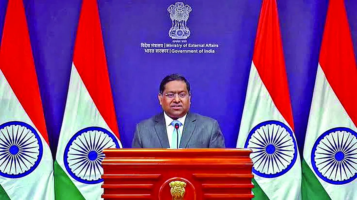
“The UN General Assembly adopted a resolution entitled “Correct the Map: Rebalancing Global Cartographic Representation and Promoting Equitable Representation of the World’s Regions, Particularly Africa” on 4 September 2026. Its purpose is to encourage the use of equal-area map projections that preserve the relative sizes of continental landmasses. The resolution neither adopts nor authenticates any particular world map, nor does it address political cartography, including international boundaries, disputed territories or place names.
India voted in favour of the resolution and also made an explanation of vote stressing on the underlying principle of promoting equal – area cartographic representation. We also highlighted that the resolution does not constitute endorsement of any specific map, projection or depiction of national boundaries. India’s sovereign territory, including the Union Territories of Jammu and Kashmir and Ladakh, must be depicted in accordance with India’s official map. Any inaccurate or misleading depiction is unacceptable. Our position on India’s sovereignty and territorial integrity is clear, consistent and non-negotiable”
— MEA on September 6, in response to media queries regarding a UN General Assembly resolution on equal-area world map
The adoption of the resolution does not mark the end of Mercator, nor should it be understood as a simple replacement of one map with another. Mercator remains useful for navigation, while other projections may be preferable for education, thematic mapping or comparative geographical analysis. The more important achievement of the resolution is that it has reopened a global conversation about cartography and power.
That conversation has particular relevance for the Global South. The demand for a more equitable world is expressed today in many forms: reform of international institutions, greater representation in global governance, recognition of historical inequalities and the search for more inclusive systems of knowledge. The debate over maps belongs within this larger intellectual and political movement.
The world is entering a period in which established hierarchies are increasingly being questioned. The rise of new economic centres, the growing influence of Africa and Asia, and the demand for institutional reform have all contributed to emergence of a more complex international order. In such a context, the image of the world itself has become part of the debate. The United Nations resolution of September 4, 2026, should, therefore, be remembered not simply as a technical decision about cartography. It represents an attempt to reconsider how humanity sees its own planet. Its practical effects will depend on whether governments, schools, publishers and technology companies choose to act upon its recommendations. Its larger significance, however, may already be clear: representation matters.
A genuinely multipolar world cannot be understood solely through political institutions while continuing to rely unquestioningly on inherited visual frameworks. The movement toward more accurate geographical representation is a modest but meaningful contribution to a broader project of intellectual equality. Correcting the map does not change the physical Earth. It changes the perspective through which the Earth is viewed—and sometimes, a change in perspective is the beginning of a change in understanding.
The factual framework concerning the UN General Assembly’s adoption of the “Correct the Map” resolution on September 4, 2026, including the recorded vote of 164 in favour, one against, and six abstentions, was checked against contemporary reporting and official/public institutional coverage, including Reuters, Associated Press, and UN-related reporting.