Siliguri Corridor, a mostly geo-strategic term often associated with the security architecture of Eastern India, is an important geo-political space that has received special attention from experts on security, strategy and foreign policy ever since India’s Independence. It has been touted as one of the most vulnerable areas of India from a security perspective, as well as the gateway to the country’s North East and by extension, towards South East Asia. The current structure and geography of this corridor is a result of gradual additions as well as losses of territory in its history. This includes various policies implemented under the British colonial rule in India, followed by subsequent treaties after Independence.
To understand the relevance of the Siliguri Corridor, one has to comprehend the historical background of settlement, migration and development of the areas which compose this corridor. And also analyse the impact of colonialism and its contributions towards the continuing security dynamics in the region. To achieve this, a detailed study of the addition of these areas into the Indian subcontinent throughout various stages of its history has been focused. It also contributes towards addressing the dearth of literature in understanding the exact area and geographical extent of the corridor with the objective of highlighting its structural composition to add to the discourse on its security which so far has been limited to the widely discussed idea that at its narrowest, the corridor is only about 20 to 22 kilometers wide.
Strategic importance of Siliguri Corridor
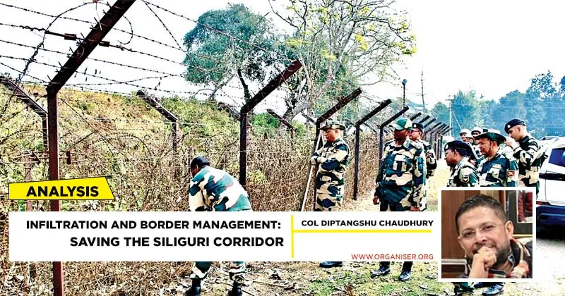
The Siliguri Corridor, often referred to as the “Chicken’s Neck“, is a narrow stretch of land in West Bengal. It connects the North Eastern States with the rest of the country.
Geographical Overview
- The corridor is situated in the Northern part of West Bengal, spanning approximately 22 kilometres
- Flanked by Nepal to the West, Bhutan to the North, and Bangladesh to the South
- Links the North-eastern Region (NER) comprising eight states—Arunachal Pradesh, Assam, Manipur, Meghalaya, Mizoram, Nagaland, Sikkim, and Tripura—to mainland Bharat
- Crucial for maintaining Bharat’s territorial integrity
- Vulnerable to external threats, especially given its proximity to the China-Bhutan border in the North and Bangladesh in the South
- The corridor serves as a vital supply route for the Indian Army, particularly for accessing forward bases in Sikkim and Arunachal Pradesh
- A gateway for trade between mainland Bharat and its North-Eastern States, facilitating the movement of goods and services
- Connects to important international trade routes, including access to Bhutan and Nepal
- Cross-border terrorism, illegal migration, and smuggling from Bangladesh add to the security challenges
- The region has seen insurgency issues in the past, requiring constant vigilance Govt Initiatives
- Border Infrastructure Development
- Investments in road and rail networks, including the Bharatmala Pariyojana and Golden Quadrilateral, aim to strengthen connectivity in the region
Act East Policy
- This policy focuses on improving trade and cultural ties with Southeast Asia, with the Siliguri Corridor acting as a vital link
Strategic Rail and Air Connectivity
- The development of Bagdogra Airport and improved rail connectivity through Northeast Frontier Railways enhances accessibility and economic prospects
The geographical extent and location of any area determines how vulnerable it may be in case of a conflict between the areas/regions it connects. If the nearby areas are mostly hostile, the area (acting as a corridor) may face threats to its own security on a long-term basis. However, if the areas connected by the corridor show signs of development and cooperation, the corridor-area/state itself may also experience the shared benefits. Nepal’s recent development indicators, as it slowly moves away from its traditional ‘yam between two boulders’ tag in South Asia, may be looked at from this perspective given the benefits it may obtain as a result of economic competition between its two neighbours: China in the North and India towards the South. Lastly, the location of such a corridor is important in determining whether it will mostly see peace or violence, development or systematic destruction from outsiders.

Glimpse into Historical Background
The present geography and demography of the areas in the Siliguri Corridor have been shaped by various events in the history of the Indian subcontinent, both preceding and following India’s Independence, most notably the Anglo-Gorkha war, the Duar war, the treaties of Sugauli and Punakha, the colonial policy of industrialisation, introduction of railways, the free movement of people and goods between India and Nepal as per the Treaty of Peace and Friendship signed by the two countries in 1950 and the creation of Bangladesh in 1971 followed by one of the largest mass migrations in the history of the world. This has been supplemented by the advent of globalisation in India towards the end of the 20th century. The process of globalisation has compounded the migration of people from less developed to more developed areas in search of a better and in today’s time, more modern standards of living. The town of Siliguri, although comparatively small in size, plays a crucial role of a transit point for road, air and rail traffic to the North Eastern States of India as well as to Nepal, Bhutan and also to Bangladesh. This has automatically turned it into an attractive destination for immigrants from nearby countries as well as for drug peddling and human trafficking and has served as a rather easy avenue for international movement and migration of elements inimical to India’s national security.
Presently, Marwaris, Punjabis, Biharis, Nepalis and Bengalis are the most prominent communities in the town of Siliguri with Hindi, Marwari, Bengali and Nepali being the most commonly spoken languages. The first instances of encouraged migration to the region date back to the early 19th century. This was mainly concentrated in and for activities related to plantation and road-building. A major portion of the plantation activities required physical labour, which as De (1990) argues, ‘was encouraged to migrate briefly in the 1830s from the Santal Parganas and then after the remarkable mortality of the tribal people in building the Pankhabari Road, from the indigent region of Eastern Nepal (Limbuan including Ilam) and further West and North’. The creation of the Bengal Presidency by the British led to the initial drawing of Bangladesh’s border with India. The division of the country on the basis of Muslim and non-Muslim majority after Independence further solidified the border. This border is 4,096 kilometers long out of which 2,217 kilometers is shared by Bangladesh and West Bengal. The Indo-Bangladesh border at Phulbari in Jalpaiguri district is located near Alipurduar, a small district of West Bengal, and is patrolled by the Indian Border Security Force on the Indian side and Border Guard Bangladesh (BGB), formerly known as Bangladesh Rifles or BDR on the Bangladeshi side. Unlike many border areas of the world which are characterised by low to zero inhabitation, the border area here is densely populated which highlights the impact of the border economy in the region, particularly augmented by the establishment of border-haats (markets). On the other hand, due to increasing reports of violence between illegal immigrants from Bangladesh and the Indian border patrol personnel, a shoot on sight policy for infiltrators was once adopted by the Indian border patrols in the border area, particularly with Bangladesh. Interestingly, the border between India and Bangladesh is heavily guarded, which is in stark contrast to India’s borders with Nepal.
Genesis of Siliguri Corridor
The present security scenario in the Siliguri Corridor has much to do with the political decisions taken in pre-Independence India. In other words, the history of the Siliguri corridor is essentially a history of the States and districts that give it shape. Present day West Bengal has gone through two Partitions in the past: once in 1905 and again in 1947. Under the British administration, Bengal which included Bihar and Orissa (Odisha) since 1765 was considered to be too large for a single province and thus difficult to govern, because of which many areas of the province had been neglected and isolated. Calcutta (now Kolkata) and its nearby areas were developed whereas areas in Eastern Bengal were poorly governed.
The present area surrounding the Indo-Nepal border has been shaped by various treaties signed between the East India Company and the Nepali rulers of the day. India’s border with Nepal is at Kachan Kawal in Panitanki area, while 22 km to the south, the Radcliffe Line separates India from Bangladesh. Hence, the boundaries that surround the corridor today are essentially man-made or artificial boundaries. Such boundaries, created mostly by the colonial powers, disrupted the linkages that had evolved over centuries in the form of family, society, culture and economy in the region. Similar scenarios elsewhere have been widely discussed by scholars of borderland studies. However, although such a boundary successfully created a new country in the form of Bangladesh for example, it failed to put an end to pre-existing linkages amongst the people living on either side of the boundary. What this means is that a problem associated with any single community in either Nepal or Bangladesh having historical linkages with such a community in India may have a spill-over effect on the Indian side.

Illegal Cross Border Activities
The narrow area of the corridor also makes it conducive for cross-border illegal activities. The corridor is at its narrowest in the area lying between Phansidewa near the Indo-Bangladesh border and Panitanki in the Eastern border between India and Nepal. In recent times, the Eastern parts of the corridor have come under the radar of security experts owing to the proximity to the Chumbi valley, where heightened tensions along the tri-junction between Bhutan, India (Sikkim) and China (the Tibetan Autonomous Region) due to the emergence of satellite images showing Chinese infrastructure build-up in the area, have led to a new security challenge in the region. Owing to the peculiar geography of the region as well as the logistical necessity for development of the north-eastern states, the Siliguri Corridor plays the critical role of a bridge between two distinct economies, one characterised by the dictates of a peripheral economy along with its associated institutions under the Ministry of Development of North Eastern Region, and the other guided by the principles of a mixed economy. Its geopolitical prospects largely hinge upon a network of developmental models in the area which range from those conceptualised by strategic experts and military generals on the one hand and institutions such as the Asian Development Bank on the other. The ongoing connectivity projects in the area attest to the prominent role that the corridor is expected to play in India’s Act East Policy eventually.
Furthermore, the sustained growth of the North-Eastern region of India depends on the development levels of the Siliguri Corridor. In terms of threat assessment regarding the Siliguri Corridor at the moment, the highly concerning ‘pincer-move of China’ theory seems implausible given the nature of Sino-Indian relations. However, flare-ups in Doklam involving India, Bhutan and China could bring about new geo-political challenges at the cost of development projects in the corridor.