




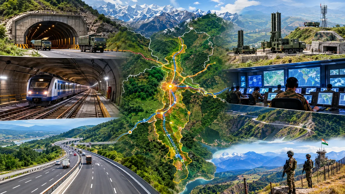
India is articulating a multilayered mega strategic architecture to fortify the vital Siliguri Corridor that bridges Northeastern India to the other regions of the country. Amid escalating geopolitical uncertainity and multi-directional threat, New Delhi is crafting the region into a more resilient strategic zone. Underground military infrastructure, additional railway capacity, alternative highways, border roads and new military installations, encompass the integrated approach to seal national security in the strategic chokepoint.
The emerging architecture is designed to ensure that disruption to any single route does not create gridlocks to the Northeast’s connection with the rest of the country. The state-of-the-art and critical infrastructure across Siliguri also aims to consolidate India’s territorial integrity against any external threats, particularlu from China and Bangladesh. The growing anti-India sentiments & security crisis in Bangladesh and China’s aggressive military manoeuvres raises apprehension, thus India is mapping a masterplan for Siliguri corridor, to contain security contingencies.
The strategic Siliguri corridor, critical for national security
The Siliguri Corridor is a narrow land link connecting mainland India with the Northeast. At its narrowest, the corridor is around 22 km wide and lies close to the borders of Nepal, Bangladesh and Bhutan, while China’s Chumbi Valley also lies nearby.
Its vulnerable & sensitive geography, bordering many countries, has made the corridor a longstanding strategic concern. The concentration of railway lines, highways, military facilities and logistical routes in a relatively confined area creates a potential vulnerability if any individual route is disrupted. India’s emerging response is therefore centred on alternative approach for critical circumstances. Instead of relying on a single road, railway or installation, the government is developing multiple parallel routes and protected facilities.
The result is an emerging seven-layer security and strategic architecture around the corridor.
1. Underground shield for ammunition and military assets
One of the most significant elements is the planned expansion of underground military infrastructure. According to details cited in various reports on the emerging plans, the Army infrastructure package at the cost of Rs. 297 crore includes
- 12 underground Army Air Defence ammunition storage facilities
- One underground Long Range Vector ammunition storage facility
- 21 overground Long Range Vector emplacements
- 12 bomb shelters
- Two critical storage spaces
Critical ammunition stocks housed underground are less exposed to threats, thus safe vulnerable surface installations. Such secret military infrastructures aids during unforesenn circumstances to thwart the atrocities of the adverseries.
The proposed infrastructure is also particularly relevant in a geographically constrained corridor where the loss of a small number of critical installations could have disproportionate consequences. The small passage also has limited space on the land for all critical installations and they are easily vulnerable. Thus, underground facilities are protective and space-economical.
2. Protected command-and-control network
The second layer focuses on keeping military decision-making and communications functioning during a crisis. Plans cited in reports include
- Five underground command-and-control centres
- Six underground communication centres
- Three underground Long Range Vector ammunition storage facilities
The strategic purpose is not simply to protect physical assets but to preserve operational continuity. Protected command, communication and storage infrastructure could provide greater resilience if surface facilities face disruption from aerial attacks, drones, electronic warfare or other forms of conflict-related damage.
The underground component represents a shift from conventional surface-based military infrastructure towards a more distributed and survivable architecture.
3. Six line underground railway: A second lifeline beneath the corridor
Perhaps the most visible component of the multi-layered Siliguri strategy is the proposed underground railway. Railway Minister Ashwini Vaishnaw announced in February 2026 that special planning was underway for the strategic corridor, including underground railway tracks and expansion of the existing railway infrastructure.
The proposed underground alignment runs from Tin Mile Haat in West Bengal to Rangapani and onwards towards Bagdogra, thus connecting the entire stretch of Siliguri. Railway officials said that the underground tracks would be around 20–24 metres below ground. The project has subsequently been notified as a Special Railway Project. A July 2026 notification covers the Dumdangi (Tin Mile Hat)-Rangapani-Bagdogra stretch of 35.76 km.
This is not merely a replacement for the existing railway. The plan envisages expanding the existing double-line section into a four-line system while adding two underground lines. Once implemented, the strategic corridor would therefore have six railway lines — four overground and two underground.
The railway network aids both civilian connectivity and movement of defence logistics. If an above-ground section is disrupted by congestion, natural disasters or a security contingency, an alternative protected railway route would provide channel.
4. Highway web to reduce dependence on a single route
The railway push is being complemented by an expanding road network. The proposed Gorakhpur-Siliguri Expressway is another important component. The Union government confirmed in Parliament in November 2024 that the Detailed Project Report, including preliminary survey and alignment studies, was in progress.
More recently, the government has also announced a major highway push connecting Siliguri with Guwahati and Shillong, alongside work on the Gorakhpur-Siliguri connection. The broader road strategy is intended to improve connectivity into the Northeast while creating additional approaches to the strategically important region.
The strategic value of such projects lies in avoiding a confinment or being locked at single-point failure. Instead of concentrating movement through one road artery, multiple highways and bridges can distribute civilian traffic, logistics and emergency movement and also transportation of military assets.
5. NH-10 and lateral routes strengthen access towards Sikkim
Another component is the strengthening of routes leading from the corridor towards Sikkim. The planned upgrades to NH-10 between Sevoke and Rangpo, along with additional lateral links between major highways, are intended to provide alternative approaches for movement towards the Sikkim sector.
This becomes particularly important because the Siliguri region is not merely the gateway to the Northeast. It is also an important logistical base for movement towards India’s northern and northeastern border areas. Additional heavy-load-capable routes therefore provide greater flexibility for the movement of military equipment and supplies.
6. Border roads expand the security grid
India’s strategy also extends beyond the immediate Siliguri urban zone. The Fatehpur-Galgalia road forms part of the Indo-Nepal Border Road programme. Government records have documented the 79.5-km stretch and its implementation under the border-road scheme. Further proposals for Indo-Nepal border roads would expand connectivity and patrol access along the frontier.
This has a dual purpose. Better roads allow security forces to reach remote border areas more rapidly while improving the ability to monitor and respond to cross-border security challenges. The proposed connectivity along the Bhutan frontier also implies security and logistics concern, where improved roads can support swift movement towards strategically sensitive areas.
7. Strategic connectivity across India-Bhutan-China tri-junction
The final layer involves strengthening the broader military and logistical network around the strategic siliguri corridor. Plans for additional military establishments are aimed at improving access and response capabilities around strategically sensitive approaches towards Sikkim and the Bhutan frontier.
The Siliguri Corridor sits in proximity to the Sikkim-Bhutan-China tri-junction region, while the Chumbi Valley is located close to the Indian and Bhutanese frontiers. Consequently, resilience around Siliguri cannot be neglected or treated as an isolated infrastructure exercise. Connectivity towards Sikkim, Bhutan and the wider eastern Himalayan region forms part of the same strategic and security dynamics of India
Siliguri Corridor: Crafting a chokepoint into a strong security grid of India
The larger significance of the emerging architecture is that India is not attempting to protect the Siliguri Corridor through a single defensive measure. Instead, the approach combines underground infrastructure, multiple railway tracks, alternative highways, lateral roads, border connectivity, protected command facilities and dispersed military assets. The broader objective is therefore resilience and strategic deterrence.
If one highway is blocked, another route can carry traffic. If an above-ground railway section is disrupted, underground capacity provides an alternative. If surface military facilities are threatened, protected underground command, communication and ammunition infrastructure can preserve critical functions.
Rather than treating Siliguri simply as a narrow geographical vulnerability, India is developing it as a multi-modal strategic network to seal national security. The emerging Siliguri fortress architecture is therefore less about building one giant fortification and more about ensuring that no single road, railway line, bridge or military installation becomes vulnerable to external threats. India’s message is clear: a chokepoint becomes far harder to choke when it has multiple layers of protection and multiple ways through!