




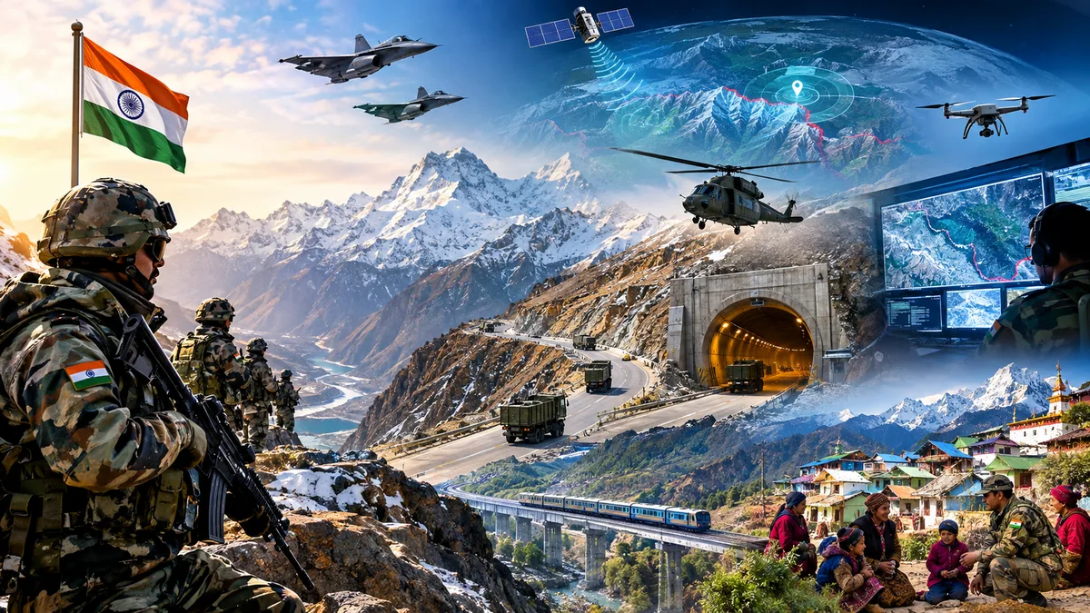
India stands amidst a volatile geopolitical latitude, with aggressive theatrics and unprecedented military postures being exhibited by the neighbouring players. Adopting heightened and utmost strategic prudence & operational readiness is thus a pivotal pillar of India’s national security playbook. As geopolitical gravity shifts to Indo-Pacific and the littoral actors emerge as increasingly assertive, it is fundamental to New Delhi’s foreign policy and military discourses to explicitly articulate an integrated and multidimensional strategic lexicon to fortify national security and territorial integrity.
As the grammar of contemporary great power politics rapidly oscillates with sheer unpredictability and the geopolitical basket of risks escalates, India is impounding its strategic propositions with significant salience, underscoring a realist approach for strategic deterrence, especially across the Himalayas to counter China’s aggressive military manoeuvres. India has adopted a multifaceted tactic to etch national security in the northern front, given the rugged and difficult mountainous terrain. From Doklam & Galwan in Ladakh to Tawang in Arunachal Pradesh, New Delhi is calibrating a comprehensive strategy as the shield against Beijing’s muscle flexing.
1. Swift connectivity, stronger logistics and strategic tunnels
India is calibrating a stronger connectivity fortress to seal national security across the strategic frontier of the Himalayas. All weather roads have been rapidly constructed to ensure critical supplies throughout the year, despite the wild conditions of the Himalayas. Helipads and landing zones are built at high-altitude regions, to ensure critical supply during unforeseen or combat circumstances.
For example, budget allocation to the Border Road Organisation(BRO) has multiplied drastically from Rs. 3,782cr in 2013-14 to Rs. 14,387cr in 2024. This will help scale up the road construction to the remotest regions and ensure last mile connectivity, upto Line of Actual Control(LAC). In this direction, road construction along the China border has doubled from 3,610kms to 6,806kms.
Apart from roads, India is also building railway lines to the border areas. This includes, Bilaspur-Manali-Leh line, which also has a dedicated military corridor. Not just Ladakh, even in Arunachal Pradesh, railway lines are drawn to the remote parts, to ensure security, sovereignty and integrate the people into the mainstream & empower them with economic opportunities.
Similarly, strategic tunnels are erected deep in the Himalayas to ensure swift connectivity throughout the year and integrate the units which were seemingly impossible previously. For example, the 13.15-km-long Himalayan tunnel promises all-weather connectivity to Ladakh while fortifying movement of military logistics and troops along the China border. This is the world’s longest single tube, bi-directional tunnel. This helps to keep operations and connectivity to Ladakh open, even during the harsh winters.
The Zojila Tunnel project is part of a mega infrastructure push by the Union government comprising 31 tunnels, 20 in J&K and 11 in Ladakh. This is aimed at boosting connectivity to the region and enhancing strategic preparedness. Once fully operational, it promises 365day connectivity between Srinagar and Ladakh while improving access to Drass, Kargil, Leh and the surrounding regions. Similarly, Atal tunnel, a high-altitude route provides year-round swift military logistics connectivity to Ladakh, by reducing transportation time by 4-5 hours.
2. High-altitude airbases and state-of-the-art landing ground
India is crafting a network of high-altitude airbases and advanced landing zones in the vicinity of Line of Actual Control(LAC). This helps in rapid deployment of troops, weapons systems and other critical supplies, even to the tricky landscapes. For example, Nyoma in Ladakh is upgraded into a high-altitude airbase at 13,700 feet. The airbase is capable of handling the advanced aircrafts such as the Rafale. Similarly, the Daulat Beg Oldi in eastern Ladakh is capable of handling Sukhoi-30 MKI, which is the world’s highest airstrip near Aksai Chin.
On the other hand, in Arunachal Pradesh, Pasighat, Walong, Ziro and even in the remotest regions such as Tuting state-of-the-art airbases are developed, which are strategically vital for national security and acts as India’s shield against China’s offensive military postures. It helps in rapid airlift of infantry, artillery and other critical supplies. They are indeed a boon to the long military logistical bottlenecks suffered by India in the dangerous terrains, but which were crucial from the security perspective.
3. Superior surveillance yields expertise in mountain warfare
India also has articulated a multi-layered, advanced, cutting-edge technology based surveillance system across the China border. This aids for real-time information, timely contact with the ground station, thus swift action and refuelling, to fortify national security. For example, the Indian Army has deployed 140-145 A-based surveillance systems to accelerate border security. These automated systems gain data from radars, thermal images and high-resolution cameras, which helps for early warning, detection and action in the strategic frontiers of Ladakh and Arunachal Pradesh.
India also uses indigenous satellites of ISRO that aids precise surveillance. ISRO has deployed a multi-layered satellite ecosystem as the watchdog of rugged Himalayan terrain and sensitive borders. This includes CARTOSAT-2 and 3, EOS-05, GSAT-7, NavIC etc. which are popularly called the “eyes in the sky”. It helps to track infrastructure development, real-time positioning and troop buildup or any other activities on the Chinese side and if they are violating India’s territorial integrity.
Similarly, India has deployed many indigenous Unmanned Aerial vehicles(UAVs) or drones for real-time border mapping, monitoring and to ensure aerial supplies. India also has developed integrated command centres and frontline communication systems in the high-altitude tactical battlefields. As a state-of-the-art effort, India is also geo-tagging the critical infrastructure and regions in the high-altitude Himalayas to harness territorial integrity and national security.
Geotagging yields positional clarity and clearly defines the Indian territories boundary and keeps a vigilance over it through satellite communication systems and tech-based surveillance mechanisms. Such state-of-the-art tech aids strategic edge in high-altitude, mountain warfare amid emerging forms of non-conventional warfare.
4. Vibrant villages, civilian fusion & a holistic approach against Chinese threat
Yet another striking feature and key pillar of India’s strategy against China, is the development of the border & remote villages, which were previously ignored, isolated and remained detached from the mainstream. As the government repeatedly asserts, border villages are not the last part of India, but they are the first villages of India and a gateway to the country. Today, border villages even in the deep Himalayas and high-altitude provinces have better road connectivity, adequate supply of essentials round the year and other critical resources.
Under the Vibrant Villages Programme, the remote and frontier villages are developed as model villages to bolster national security. It is a strategic initiative to harness the border areas as a frontier community to seek national security against any threat. The villages are developed with all the amenities and critical infrastructure. This civilian fusion, coupled with military strength acts as a strategic impetus against external threats. The local residents act as “eyes and ears” of the intelligence, help in early warning and act as the first line of moral defence.
New Delhi has thus harnessed a multi-layered, integrated and holistic strategy against the geopolitical aggression of China. Swift connectivity, solid air and tech power, strong manpower who are expertised in mountain warfare, state-of-the-art infrastructure and the civil-military integration is redefining India’s strategic capabilities to seal national security and territorial integrity.