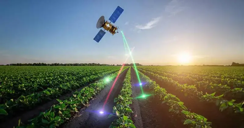
The agricultural landscape of India, which was traditionally affected by monsoons due to manual assessments, is now transforming not from the ground level but from space. The Indian Space Research Organisation (ISRO), functioning under the Department of Space (DoS) has established itself as a facilitator of this revolution through the application of satellite technology, geospatial intelligence, artificial intelligence etc. By revolutionising farming practices, India’s agricultural landscape is being redefined. In the context of climate variability, population growth, and resource availability, India’s agricultural sector is being revolutionised through the application of space technology. Unlike the application of technology being a standalone is being integrated with the governance structure of the country.
Journey from Experimental Satellites to Operational Systems
ISRO’s interaction with agriculture began in the 1970s, when the first remote sensing experiments were conducted using satellites such as Bhaskara. This gradually transformed into full-fledged programs. An important milestone in this regard was the initiation of the Crop Acreage and Production Estimation (CAPE) project by the Space Applications Centre (SAC) in Ahmedabad in 1992. This project initially focused on kharif rice in some states. This marked the beginning of satellite-based crop forecasting.
This shift from experimental research to full-fledged programs gained momentum in the following years. In the 2010s, the interaction with the Ministry of Agriculture and Farmers Welfare (MoA&FW) helped scale up the programs. Initiatives like CHAMAN for horticultural crops and NADAMS for drought monitoring demonstrated a shift towards full-fledged agricultural intelligence.
A significant policy shift was seen in the Indian Space Policy-2023. This policy made satellite data available to the people. The data obtained through remote sensing using Indian satellites was made available free of cost to government agencies. The data at a coarser resolution was made available to the general public. This move has catalysed the growth of digital agriculture platforms and expanded the reach of space-based applications.
Flagship Programmes Driving Agricultural Intelligence
At the heart of ISRO’s efforts to transform the agricultural sector lies a suite of flagship programmes that integrate satellite data with ground data and meteorological information.
ISRO’s FASAL (Forecasting Agricultural output using Space, Agrometeorology and Land-based observations) program offers crop forecasts for the coming seasons, including rice and wheat. This program helps improve the accuracy of acreage and yield estimates by integrating satellite data.
Another flagship program is the National Agricultural Drought Assessment and Monitoring System (NADAMS), which provides regular assessments of drought conditions using satellite data on crop health, rainfall, and soil moisture. This helps in the early identification of drought conditions. For the horticulture segment, the CHAMAN program helps map the area under fruit and vegetable cultivation in specific districts.
The SUFALAM initiative combines various datasets to provide food security through crop production forecasting, price prediction, and precision agriculture tools. Its ongoing Phase-II (2024-2027) focuses on improving decision support systems and advisory services. These programs provide a holistic platform for agricultural monitoring at national, regional, and local levels.
Technological Innovations Transforming the Field
The role of ISRO does not end with data accumulation; rather, it begins with the creation of advanced tools and methodologies for interpreting satellite data. The most notable innovation introduced by ISRO is its AI-based crop mapping tool SASYA, which utilises C-band Synthetic Aperture Radar data from EOS-04 (RISAT-1A) satellite imagery.
This tool, integrated with the BHOONIDHI geoportal, enables precise crop identification even under cloudy conditions, a major drawback of satellite imagery. In the domain of yield estimation, ISRO has introduced the concept of Smart Sampling through the YES-TECH initiative of the Pradhan Mantri Fasal Bima Yojana (PMFBY). This optimises the selection of Crop Cutting Experiment locations.
To further strengthen the domain of crop yield estimation, ISRO has developed GeoCrEST, an automated geospatial system for crop yield estimation. This system is operational through the VEDAS geoportal.
ISRO has also developed machine-learning-based and semi-physical models for crop yield estimation, which greatly reduce dependence on manual interventions. These innovations have introduced objectivity and transparency to the assessment process. ISRO is also providing value-added agro-meteorological products through the VEDAS system to support 85 districts and 500 blocks through the Gramin Krishi Mausam Seva (GKMS).
Strengthening Natural Resource Management and Data Infrastructure
Another important aspect of ISRO’s work is natural resource management. In this regard, the National Agricultural Land Use Mapping Programme generates data at different scales: annual-scale data at 1:250K, quinquennial-scale data at 1:50K, and decadal-scale data at 1:10K. This helps with planning, assessment, and food security strategy.
Free data from satellite resources, including C-band SAR data from the EOS-04 mission, has helped strengthen the data available for the Indian agricultural sector. The high-resolution data available through the Agri Stack project for 13 states will help the digital agriculture drive.
Platforms like BHOONIDHI and VEDAS have become the central repositories for data dissemination. This has helped create a robust ecosystem for evidence-based agricultural governance.
Collaborative and State-Level Interventions
In view of the country’s agricultural diversity, various state-specific or collaborative projects have been undertaken by ISRO. In Odisha, the Crop Insurance Decision Support System was implemented to support the insurance system by providing tools for geospatial determination of crop area and yield estimation. In the state of West Bengal, the Bango Sasya Beema Yojana was enhanced to include the results of remote sensing analyses.
In the state of Maharashtra, the project MahaAgriTech was implemented to provide a comprehensive geospatial platform to support crop assessment, yield estimation, and disaster impact assessment. In the state of Madhya Pradesh, the MP-AgriGIS project was implemented to support digital agriculture planning by identifying crops and estimating sown area.
In the North Eastern Region states, the projects named ASAAN and SSDIH were implemented to support crop estimation, the determination of cropping patterns, and horticultural infrastructure. Completed projects at the national level include crop intensification mapping in eastern states and crop residue assessments for bioenergy purposes. In the pipeline, projects such as FASAL 2.0, India Potato Crop Monitoring, and SUFALAM Phase-II promise to take forecasting and decision-support systems to even greater heights.
Quantifiable Impact on Farmers and Governance
The impact of ISRO’s space-based agricultural interventions is quantifiable and transformative. Perhaps the greatest achievement has been in crop insurance. Under the YES-TECH program, satellite-based data integration has reduced premium rates from 17 per cent to 12 per cent.
A socio-economic survey conducted in Parbhani, Maharashtra, during the Kharif season of 2022-23 revealed that the use of satellite-based advisories has improved productivity in soybean and cotton crops by 2 to 5 per cent, besides reducing input costs by 5 to 10 per cent.
At the national level, the use of satellite-based systems has improved the accuracy of estimates of crop acreage and production, thereby aiding better policy and planning for food security management. Satellite-based systems have helped identify the potential for developing certain crops and horticultural practices, thus aiding diversification and income enhancement. The monitoring of drought conditions by NADAMS has helped the government respond better to climatic stress.
Challenges and the Road Ahead
Despite these advances, challenges remain. Cloud cover in certain regions still poses a challenge for optical satellite systems. The introduction of SAR technology has significantly minimised this challenge. Moreover, the integration of satellite technology with on-ground technologies like IoT and mobile technologies still needs to be developed. This is due to limitations in last-mile connectivity.
Capacity building among farmers and on-ground agencies also needs attention. Ensuring that the benefits of space technology percolate down to farmers remains a priority. Future initiatives like advanced forecasting systems through FASAL 2.0 and advanced crop monitoring systems like IPCM aim to bridge the gap. In addition, there is a need to introduce artificial intelligence in the systems.
A Model for Global Agricultural Innovation
The approach adopted by ISRO in facilitating agricultural transformation can be regarded as a unique model that combines technology with policy interventions. By linking its interventions to national programs such as PMFBY and digital agriculture programs, ISRO has ensured that space technology contributes to farmers’ welfare.
At a global level, India’s programs can be regarded as unique compared to those of other countries. Although other countries may also be undertaking similar programs, the ISRO model can be regarded as unique and tailored to meet the needs of a large agrarian population.
Bridging Space and Sustainability
The integration of space technology into agriculture represents a paradigm shift in how India approaches food security, resources, and rural development. ISRO initiatives have changed the face of agriculture from a reactive mode to a proactive one.
By facilitating the precise monitoring of agricultural activities, accurate forecasting of climatic conditions, and informed decision-making, ISRO initiatives have ensured that agricultural productivity is not only increased but also that the agricultural sector is made resilient to climate uncertainties. As India moves further along the trajectory of self-reliance and sustainability, the interrelationship between space technology and agriculture will remain a key feature of the nation’s development.
From satellites floating hundreds of kilometres above Earth’s surface to farmers tilling the soil on Earth’s surface, ISRO has succeeded in bridging the relationship between space technology and agriculture.