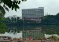
Hyderabad has established itself as a hub for top global companies, making it one of India’s most innovative centres for technology, pharmaceuticals and research. As the city expands in all directions and attracts global attention, a familiar Congress tactic has resurfaced—this time disguised as administrative reform. In theory, reform should mean better governance, improved service delivery, rational planning, and democratic consultation. What Hyderabad is witnessing today reflects none of these principles. It is political engineering through city delimitation, and it comes at the direct cost of the city’s future.
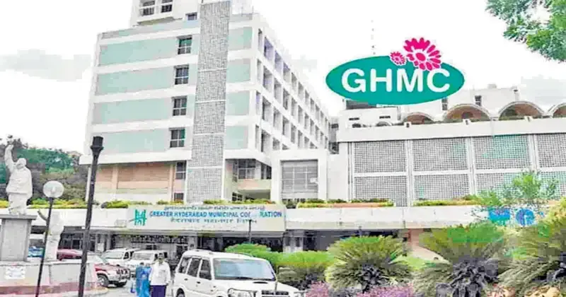
The Congress government has merged 27 urban municipalities into the Greater Hyderabad Municipal Corporation (GHMC), expanding the city’s jurisdiction from roughly 625 square kilometres to over 2,000 square kilometres. These municipalities span Medchal–Malkajgiri, Rangareddy and Sangareddy districts. The expansion was executed through notifications, without meaningful consultation with elected representatives, without publicly released population, fiscal or infrastructure modelling and without any phased administrative transition plan. This is not routine governance. It is a structural intervention with immediate and long-term political consequences.
Alongside this territorial expansion, the government has doubled the number of municipal wards from 150 to 300 and increased the number of mayors from one to three. This redrawing of the municipal map was rushed through within days of the merger, without a transparent population parity framework or a clear explanation of representational logic. Elected representatives from the 27 merged municipalities—covering nearly half of the expanded GHMC area—were entirely excluded from the process. The city’s democratic mandate is being reshaped not through deliberation, but through arithmetic.
The effects are visible in how ward boundaries are being structured. In the core GHMC area, particularly in the Old City, boundaries are being carefully protected and reshaped to preserve existing vote banks. In contrast, in the newly merged municipalities, neighbourhoods are split, clubbed or diluted to break political coherence. Opposition-supporting localities are chopped into multiple wards; demographically distinct areas are forcibly fused; natural boundaries, revenue limits and local identities are ignored. This is not neutral delimitation. It is vote engineering.
Such outcomes are not without precedent. From the imbalances triggered at independence to politically driven delimitation exercises in undivided Andhra Pradesh under the Congress rule, boundary-making for electoral ends has repeatedly produced instability rather than integration. Congress’s historical reliance on appeasement politics as an organising principle is well documented and the manner in which this exercise has been executed follows that familiar pattern.
Recent public remarks by the current Chief Minister—explicitly framing the party’s political identity in minority terms—reinforce this reading by anchoring political strategy in communal arithmetic rather than civic governance. The parallels with the approach adopted during Y. S. Rajasekhar Reddy’s tenure in undivided Andhra Pradesh, when Hyderabad’s boundaries and administrative decisions were similarly leveraged for electoral consolidation, are difficult to ignore.
By embedding demographic and communal imbalance into the ward structure, the present exercise distorts political representation and weakens accountability. Governance becomes contingent on bloc control rather than service delivery, fiscal prudence or long-term planning— conditions essential for Hyderabad to function as a genuinely global and well-governed city. When ward boundaries consistently concentrate power within a single communal bloc, institutional checks weaken and enforcement becomes selective rather than uniform. Decisionmaking follows numerical dominance, not civic necessity.
The risks are not abstract. Hyderabad is already struggling with traffic paralysis, routine flooding, unreliable water supply, outdated drainage systems, sewage overflow, congestion and crumbling roads. Yet instead of addressing these structural failures, the government’s priority has been redrawing lines on a map. There has been no financial modelling for a 2,000-square-kilometre GHMC, no assessment of manpower requirements, no transport or environmental study. GHMC is being treated less as a civic institution and more as an instrument for political control and real estate expansion. Citizens inherit administrative chaos; insiders inherit profit.
Urban governance has been reduced to high-decibel events and headline management. Summits substitute for strategy, spectacle stands in for administration, and publicity is mistaken for progress. The Rising Telangana Summit offered optics without an urban roadmap. Celebrity visits became theatre for a city struggling with drains, buses and water. This is governance hollowed out and replaced with noise.
Hyderabad today is being split into two realities. One is a curated, camera-ready city marketed through select western corridors. The other is the lived city—merged municipalities, overcrowded core zones, neglected peripheries, and unplanned colonies—abandoned by serious governance. This duality is not accidental; it is the outcome of deliberate political design.
At a time when the world looks to BJP-led administration in India for examples of infrastructure led growth, regulatory predictability, and administrative capacity, the present Congress regime has moved Hyderabad in the opposite direction. Global cities such as London, Paris, Sydney and Brussels offer cautionary lessons on how sustained governance failure combined with demographic imbalance fuels social fragmentation, insecurity, and uneven civic outcomes.
And yet, Hyderabad is being cut, carved, and rigged.
This is not merely an administrative failure; it is a warning. Hyderabad is slowly sliding into the grip of modern Razakars and their political patrons who are bent on weakening democratic processes. Hyderabad is not Congress property. It is not AIMIM territory. It belongs to its people.