




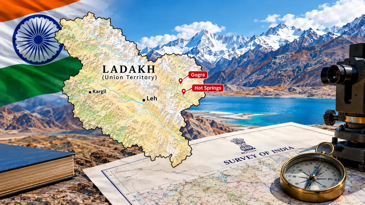
NEW DELHI: The Centre has standardised the names of 28 places and geographical features in Ladakh for inclusion on the official maps of the Survey of India (SoI), in consultation with the Union Territory administration. The exercise covers peaks, mountains, passes, glaciers, valleys, rivers, lakes and land areas, including strategically significant locations such as Gogra and Hot Spring.
The move is aimed at ensuring uniform geographical identification, preserving consistent cartographic records and increasing public awareness about the region’s historical, cultural and geographical features.
To counter China’s territorial claims & renaming in Eastern Ladakh, India has formally identified 28 places & features in Ladakh by standard names on official Survey of India maps pic.twitter.com/yu8DbnOoD3
— Himanshu Jain (@HemanNamo) October 2, 2026
Centre standardises names of 28 geographical features in Ladakh
The Union Ministry of Home Affairs (MHA) said that the government had formally identified 28 places and geographical features in Ladakh by standardising their names on the official Survey of India map. According to the Ministry, the exercise was undertaken in consultation with the Ladakh administration to facilitate the accurate recognition of these locations and improve public awareness about their names and geographical significance.
The identified geographical features include mountain peaks, passes, glaciers, valleys, rivers, lakes, water bodies and land areas. Their inclusion in official cartographic records provides standardised references for government agencies, mapping authorities and other institutions that rely on geographical information.
The move also brings greater consistency to the recording and identification of locations across official maps and administrative documents. The government has indicated that the identified features can be viewed on the Survey of India’s official map of Ladakh.
Zorawar peak, Kanishka peak and other names on the list
The list of 28 features includes several peaks whose names carry historical, religious and cultural associations. Among the identified peaks are Atisha Giri, Kanishka Peak, Martand Giri, Zorawar Peak, Rinchen Zangpo, Sakyasri Giri, Marpa Lotsava Ri, Milarepa Kangri, Shiva Ri and Maheshvara Ri.
The names associated with Buddhist scholars and spiritual figures reflect the historical and cultural connections of the wider Himalayan region. Atisha, Rinchen Zangpo, Marpa Lotsava and Milarepa are associated with Buddhist learning and traditions that have influenced the religious and intellectual history of the Himalayas.
Other names, including Shiva Ri and Maheshvara Ri, draw upon Hindu religious traditions. Their formal recording on official maps gives these geographical features standardised names within India’s national cartographic framework. Zorawar Peak also carries a historical association with General Zorawar Singh, the Dogra military commander known for his campaigns in the Himalayan region during the 19th century.
The list further includes Karun Pir, Drak Karpo and Jolmori, which have been classified as mountains.
Passes, glaciers, rivers and lakes form part of the exercise
Beyond peaks and mountains, the standardisation covers several other geographical features that contribute to the region’s diverse landscape. Chapchingal Pass and Shachmirk Pass have been designated as mountain passes, while Parpik and Skamri have been identified as glaciers. Shkorga Valley has been recorded as a valley, and Yangpa River as a river.
The list also includes Guru Rinpoche Lake, classified as a lake, and Hot Spring, designated as a water body. Seven land areas identified in the exercise are Brangsa, Kuksel, Dehra Compass, Gogra, Kumarayana Point, Panglung and Shamal Lungpa.
Standardising their nomenclature helps reduce inconsistencies in spelling, classification and usage, particularly when different agencies refer to the same locations in official documents and mapping exercises. The exercise is therefore relevant not only to cartography but also to the consistent documentation of the region’s geographical features.
Gogra and Hot Spring hold strategic significance to fortify national security
The inclusion of Gogra and Hot Spring is particularly relevant because the locations were intruded by China, that led to a prolonged standoff in eastern Ladakh.
The Galwan clash escalated by China in 2020 and the subsequent military standoff led to complete freeze of Sino-India ties. Years of diplomatic negotiations led to gradual de-escalation and disengagement at several friction points, including Gogra and Hot Springs. Their inclusion in the standardised list provides a cartographic clarity to secure sovereignty and territorial integrity of India.
India rejects China’s stunt to rename Indian territories
The Ladakh exercise by India comes amid China’s practice of publishing Chinese-language names for locations in Indian territory particularly in Arunachal Pradesh. Beijing’s actions reflect cartographic aggression. Thus, India’s latest standardisation of names in Ladakh is an attempt of strategic clarity and reiterating India’s sovereignty.
Beijing refers to Arunachal Pradesh as ‘Zangnan’, or southern Tibet, and has periodically released lists of names for places in the Indian state. India has consistently rejected these attempts, maintaining that Arunachal Pradesh is an integral part of the country and that assigning new names cannot alter territorial realities and it is a clear violation of India’s sovereignty.
India standardised names of 27 places in Arunachal Pradesh
In August 2026, the Centre had also standardised the names of 27 places and geographical features in Arunachal Pradesh for inclusion on Survey of India maps. The two exercises reflect the government’s continued emphasis on maintaining consistent official geographical records for India’s frontier regions and re-emphasising India’s sovereignty.
The Survey of India, under the Department of Science and Technology, is the country’s national mapping agency. It undertakes surveying and mapping activities and prepares official maps used for geographical reference and a range of administrative purposes.