




India hails UN resolution on equal area maps, reaffirms sovereignty
September 6, 2026
  • Read Ecopy
  • Circulation
  • Advertise
  • Careers
  • About Us
  • Contact Us
Android AppiPhone AppArattai
Organiser
  • ‌
  • Bharat
    • Assam
    • Bihar
    • Chhattisgarh
    • Jharkhand
    • Maharashtra
    • View All States
  • World
    • Asia
    • Europe
    • North America
    • South America
    • Africa
    • Australia
  • Editorial
  • International
  • Opinion
  • RSS @ 100
  • More
    • World Hindu Congress 2026
    • Op Sindoor
    • Analysis
    • Sports
    • Defence
    • Politics
    • Business
    • Economy
    • Culture
    • Special Report
    • Sci & Tech
    • Entertainment
    • G20
    • Azadi Ka Amrit Mahotsav
    • Vocal4Local
    • Web Stories
    • Education
    • Employment
    • Books
    • Interviews
    • Travel
    • Law
    • Health
    • Obituary
  • Subscribe
    • Subscribe Print Edition
    • Subscribe Ecopy
    • Read Ecopy
  • ‌
  • Bharat
    • Assam
    • Bihar
    • Chhattisgarh
    • Jharkhand
    • Maharashtra
    • View All States
  • World
    • Asia
    • Europe
    • North America
    • South America
    • Africa
    • Australia
  • Editorial
  • International
  • Opinion
  • RSS @ 100
  • More
    • World Hindu Congress 2026
    • Op Sindoor
    • Analysis
    • Sports
    • Defence
    • Politics
    • Business
    • Economy
    • Culture
    • Special Report
    • Sci & Tech
    • Entertainment
    • G20
    • Azadi Ka Amrit Mahotsav
    • Vocal4Local
    • Web Stories
    • Education
    • Employment
    • Books
    • Interviews
    • Travel
    • Law
    • Health
    • Obituary
  • Subscribe
    • Subscribe Print Edition
    • Subscribe Ecopy
    • Read Ecopy
Organiser
  • Home
  • Bharat
  • World
  • Operation Sindoor
  • Editorial
  • Analysis
  • Opinion
  • Culture
  • Defence
  • International Edition
  • RSS @ 100
  • Magazine
  • Read Ecopy
Home International Edition News

MEA backs UNGA resolution on cartographic depiction; Reaffirms India’s non-negotiable sovereignty over J&K and Ladakh

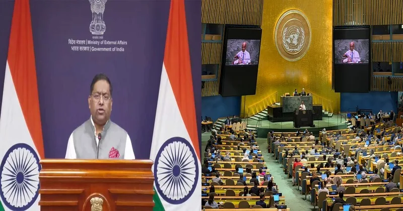
The Ministry of External Affairs backed UNGA resolution on equal-area cartographic projections & reiterated that international boundaries must strictly adhere to India's official maps. MEA also reaffirmed India's territorial integrity & sovereignty especially over J&K and Ladakh as clear, consistent & non-negotiable

WEBDESKWEBDESK
Sep 6, 2026, 04:00 pm IST
inNews, World, India, International Edition
Follow on Google News
MEA backs UNGA resolution on cartographic representation

MEA backs UNGA resolution on cartographic representation

Facebook
Twitter
WhatsAppTelegramEmail

New Delhi: India has voted in favour of a United Nations General Assembly (UNGA) resolution advocating for equal-area cartographic projections while firmly stating that its international boundaries, including the Union Territories of Jammu and Kashmir(J&K) and Ladakh, must strictly adhere to India’s official territorial maps.

Responding to media inquiries regarding India’s position, Ministry of External Affairs (MEA) spokesperson Randhir Jaiswal outlined the adoption and core scope of the resolution. Clarifying India’s submission alongside its vote, Jaiswal emphasised that supporting equal-area technical representations does not override national territorial sovereignty.

Our response to media queries regarding a UN General Assembly resolution on equal-area world map ⬇️

🔗 https://t.co/sAnpGhX3fA pic.twitter.com/Cfyn3jMcOG

— Randhir Jaiswal (@MEAIndia) September 6, 2026

“India voted in favour of the resolution and also made an explanation of the vote, stressing the underlying principle of promoting equal area cartographic representation. We also highlighted that the resolution does not constitute endorsement of any specific map, projection or depiction of national boundaries”, he added.

“India’s sovereign territory, including the Union Territories of Jammu and Kashmir(J&K) and Ladakh, must be depicted in accordance with India’s official map. Any inaccurate or misleading depiction is unacceptable. Our position on India’s sovereignty and territorial integrity is clear, consistent and non-negotiable”, MEA spokesperson further reiterated.

UN resolution on correct cartographic representation; A response to Africa’s campaign

The UN General Assembly adopted a resolution entitled “Correct the Map: Rebalancing Global Cartographic Representation and Promoting Equitable Representation of the World’s Regions, Particularly Africa” on September 4, 2026.

The resolution stems from an African-led campaign to move away from the traditional 16th-century Mercator projection, which heavily exaggerates landmasses near the poles while visually shrinking equatorial regions such as Africa and South America.

Congratulations to the delegation of #Togo 🇹🇬 and the Africa Group on the adoption this morning by the #UNGA of resolution A/80/L.104, “Correct the Map.”

First endorsed by the African Union Assembly in February and officially passed at the United Nations today, this… pic.twitter.com/wHxblZ8d3K

— African Union (@_AfricanUnion) September 4, 2026

“Its purpose is to encourage the use of equal-area map projections that preserve the relative sizes of continental landmasses. The resolution neither adopts nor authenticates any particular world map, nor does it address political cartography, including international boundaries, disputed territories or place names”, added Jaiswal.

Rather than banning older maps or mandating a single alternative, the UNGA encourages governments, academic bodies and technology firms to utilise equal-area options, such as the Equal Earth projection, when accurate relative land sizing is required.

The measure passed with overwhelming global support, receiving 164 affirmative votes. Six nations, Estonia, Georgia, Lithuania, Moldova, Serbia and Ukraine, abstained, while the United States cast the sole vote against the resolution.

Also Read: US federal Judge blocks Trump’s birthright citizenship order again, declares it ‘almost certainly unconstitutional’

Mercator projection provides inaccurate picturisation near poles & equator

While the Mercator projection remains widely used because of its usefulness for navigation, its visual representation can make areas closer to the poles appear disproportionately large compared with regions near the equator. The Mercator projection makes landmasses near the poles look much larger than they actually are while showing regions near the equator at their true relative size.

On a map using the Mercator projection, Greenland looks about the same size as Africa. In reality, Africa is about 14 times larger than Greenland. Greenland covers about 2.16 million square kilometres, while Africa covers about 30.37 million square kilometres.

On the map, Alaska appears to be roughly the same size as Brazil. In reality, Brazil is nearly five times larger than Alaska. Alaska is about 1.7 million square kilometres, while Brazil is about 8.5 million square kilometres.

Antarctica appears massive at the bottom of a Mercator map, stretching out to look like an enormous continent that dominates the bottom of the world. While it is still large, its visual area is heavily exaggerated compared to landmasses near the middle of the map.

(With Inputs from ANI)

Topics: Equal Area MapsIndiaLadakhUNGAAfricaJ&KMEACorrect the Map
Share
Tweet
SendShareSend
✮ Subscribe Organiser YouTube Channel. ✮
✮ Join Organiser's WhatsApp channel for Nationalist views beyond the news. ✮
Previous News

Fact-Check: CJP’s Saurav Das shares AI-generated quote attributed to Gaurav Bhatia, deletes after 24-hour ultimatum

Related News

Ladakh: 36 dams planned on Indus after Upshi pilot project; Aids to irrigate large tracts of land, a boon to farmers

India ramps up aid to flood-hit Nepal

Nepal Floods: Death toll hits 1,344; India airlifts 7th aid tranche, deploys tunnel rescue team for relief efforts

Belgian PM De Wever and Prime Minister Modi

“India Warned, We Ignored”: Belgium PM De Wever flags Europe’s economic dependence; Lauds PM Modi as inspiring leader

Prime Minister Modi & Uzbekistan President Shavkat Mirziyoyev

Uzbekistan envoy hails India’s 7.8% growth amid global upheavals; Calls New Delhi & Tashkent as complementary economies

Belgium PM Bart De Wever and Prime Minister Narendra Modi

PM Modi-PM De Wever Bilateral Talks: India-Belgium deepen defence, trade, critical minerals & clean energy partnership

AI Generated Representative Image

Japan Credit Agency Upgrades India to “A” Rating: Strong institutional reforms drive growth despite global headwinds

Load More

Latest News

MEA backs UNGA resolution on cartographic representation

MEA backs UNGA resolution on cartographic depiction; Reaffirms India’s non-negotiable sovereignty over J&K and Ladakh

Gaurav Bhatia (L) and Saurav Das (R)

Fact-Check: CJP’s Saurav Das shares AI-generated quote attributed to Gaurav Bhatia, deletes after 24-hour ultimatum

Jordanian journalist Abdullah Ibhais, who exposed Qatar’s Kafala system and was released in March 2025 after serving three years of a five-year sentence

Who Is Abdullah Ibhais? Qatar’s Kafala slavery whistleblower abducted ahead of US testimony on 2022 football world cup

Representative image

Rising cases of ‘Love Jihad’: Ten disturbing cases reported across Bharat in one week

Bridging generation gap in the information age!

A representative image

Hijab not an essential religious practice: 8 Indian court rulings on school dress codes, exams and religious freedom

AI Generated Representative Image

Hindutva for humanity and global harmony

An AI generated image for representation

Hindu Hate Watch-A Weekly Tracker: 65 cases of threats, assaults, murder and converted reported across Bharat & abroad

Perumal Sthapati is a master sculptor from Mamallapuram who has spent decades creating Hindu deities and temple sculptures in stone

Perumal Sthapati: The master sculptor from Mamallapuram bringing Hindu deities & ancient mandir art to life in stone

An AI Generated Image

Hindu Hate Watch-A Weekly Tracker: 46 cases of threats, abuses, conversion, assault & murders reported across Bharat

Load More
  • Privacy
  • Terms
  • Cookie Policy
  • Refund and Cancellation
  • Delivery and Shipping

© Bharat Prakashan (Delhi) Limited.
Tech-enabled by Ananthapuri Technologies

  • Home
  • Search Organiser
  • Bharat
    • Assam
    • Bihar
    • Chhattisgarh
    • Jharkhand
    • Maharashtra
    • View All States
  • World
    • Asia
    • Africa
    • North America
    • South America
    • Europe
    • Australia
  • Editorial
  • Operation Sindoor
  • Opinion
  • Analysis
  • Defence
  • Culture
  • Sports
  • Business
  • RSS @ 100
  • Entertainment
  • More ..
    • Sci & Tech
    • Vocal4Local
    • Special Report
    • Education
    • Employment
    • Books
    • Interviews
    • Travel
    • Health
    • Politics
    • Law
    • Economy
    • Obituary
  • Subscribe Magazine
  • Read Ecopy
  • Advertise
  • Circulation
  • Careers
  • About Us
  • Contact Us
  • Policies & Terms
    • Privacy Policy
    • Cookie Policy
    • Refund and Cancellation
    • Terms of Use

© Bharat Prakashan (Delhi) Limited.
Tech-enabled by Ananthapuri Technologies