Pakistan is going through political turmoil as Pakistan Prime Minister Imran Khan Niazi has lost the trust of the parliament and the ‘establishment’.
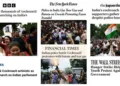
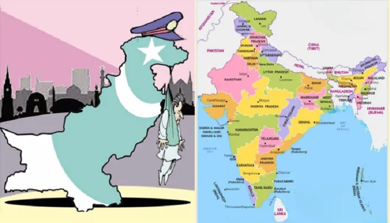
India’s leading newspaper published a report about the ongoing political crisis in the neighbouring country and published a wrong map of Pakistan in its report.
The map The Times of India published showed PoK (Pakistan Occupied Kashmir) as part of Pakistan.
Kashmir has always been an integral part of India. Pakistan and China are illegally occupying a part of it.
Netizens protested the wrong political map of Pakistan published by ToI. On different social media platforms, netizens demanded Prime Minister Narendra Modi, Union Home Minister Amit Shah and Union IT Minister Ashwini Vaishnaw.
One Twitter user, Manoj Chaudhary, posted, “They are not afraid of Home Ministry or Court or officials, truly a free press of India, can print ANY thing & everything against India.”
Another Twitter user suggested that it has been done deliberately by The Times of India, and strict action must be taken against the newspaper.
The Union government had proposed a bill in May 2016 which had provisions of a seven-year jail term and 100 crores fine for depicting the wrong map of India.
The draft bill ‘Geospatial Information Regulation Bill 2016’ has a mandatory provision to take permission from a government authority before “acquiring, disseminating, publishing or distributing any geospatial information on India.”
“No person shall depict, disseminate, publish or distribute any wrong or false topographic information of India, including international boundaries through internet platforms or online services or in any electronic or physical form,” the draft bill has proposed.
If the offence was committed, the draft bill says, “Whoever acquired any geospatial information of India in contravention of the law shall be punished with a fine ranging from ₹ 1 crore to ₹ 100 crore and/ or imprisonment for a period up to seven years.”
The setting up of a Security Vetting Authority was also proposed to carry out security vetting of the geospatial information of India in a time-bound manner and as per the regulations framed by an apex committee.
Massive protests had erupted in 2016 after Twitter showed the geographical location of Kashmir in China and Jammu in Pakistan.
The draft bill had provisions that tech platforms like Google, Twitter, Facebook etc., using geospatial information, would need to apply for a licence, and the Security Vetting Authority would properly scrutinise the application before issuing the licence.