Column:Himalayan Misadventure: VIII
There is much that is not commonly known about the shocking aspects of the 1962 India-China War, so shocking indeed that S Gopal, Nehru's official biographer, was constrained to comment: “Things went so wrong that had they not happened it would have been difficult to believe them.” The Henderson-Brooks report covered only the limited aspects their authors were tasked with. The book “Foundations of Misery” by Rajnikant Puranik in its chapter “Himalayan Misadventure” details all the aspects of that avoidable war. We are serialising that chapter.
Arun Shourie quotes Nehru in ‘Are we deceiving ourselves again?’: “It is completely impracticable for the Chinese Government to think of anything in the nature of invasion of India. Therefore I rule it out… It is necessary that the system of check-posts should be spread along this entire frontier. More especially, we should have check-posts in such places as might be considered disputed areas…As Demchok is considered by the Chinese as a disputed territory, we should locate a check-post there. So also at Tsang Chokla…”
China seemed to have viewed India's Forward Policy as a deliberate attempt to usurp Chinese territory, and provoke war. As things stood, China was suspicious of India’s intentions.
Galwan Valley and Dhola Post
July 1962. India had set up a post in the Galwan valley in the western sector which outflanked a Chinese post further down. Although some Indian officials had advised against setting up of such a post, they were overruled. When Chinese diplomatic protests were not heeded, they surrounded the post on 10 July 1962 but did not fire. They left after a warning. This led Nehru and group to conclude what they wanted to conclude—that China would not attack, and India could carry on with its forward policy games!
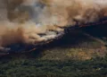
September 1962. Under the renewed rigour in the implementation of the forward policy under BM Kaul in NEFA, a post was set up south of Thagla ridge at Dhola, on the southern bank of the Namka Chu river. Chinese protested saying its location was beyond the McMahon Line into their territory. It appears that the local Indian army commanders in NEFA did not have a clear idea on borders—the maps were not detailed and accurate enough—and might have erred in setting up some posts in disputed areas or areas beyond the border. This possibility was perhaps examined in the Henderson-Brooks report that remains classified till date. The Chinese team headed by Zhou that had visited India in 1960 to settle the border issue had, in their discussions, raised questions on the alignment of McMahon Line in the Thagla Ridge area.
Writes Brigadier Dalvi, who fought the 1962-war in the area, in Himalayan Blunder about the April-1962 episode of the Operation Onkar, meant to implement the Forward Policy, “From the outset it should have been appreciated that a move into the Dhola area would attract Chinese attention, if not a severe reaction. The area of the Tri-junction [of Tibet, Bhutan and India] was extremely sensitive, as the exact alignment of the McMahon Line had been made the subject of open dispute by China. Apart from the incident of August 1959, which brought the army into NEFA, we knew (or should have known) that Chinese officials in the 1960 discussions had not conceded our version of the Line in this particular area. I was naturally doubtful about activating a sensitive area, specially after I had seen for myself the difficulties of moving and maintaining a force there. The Thagla Ridge had a tactical significance for the Chinese as it overlooked their forward base at Le…When these awkward questions were raised, I was told categorically to ‘lay off’ as this was a ‘matter of national policy’ and was being implemented by the Assam Rifles…The persons who set up Dhola without the necessary military might to slug it out with the Chinese are guilty of providing the Chinese with the excuse they wanted; and of placing the Indian army in a shameful and invidious position… “I studied the ground and realised that Dhola was militarily useless, indefensible and dominated by Chinese positions and located in a trap.”
Dhola is 60 km from Tawang and 200 km from the railhead of Misamari. The Nyamjang river flows through from Tibet, enters India at Khinzemane, and meets Namka Chu 2.5km south of Khinzemane. There were seven improvised bridges—numbered I to V from east to west, with Log bridge and Temporary bridge between IV and V—across the Namka Chu river used by local graziers to take their cattle across. Dhola Post was opposite Bridge III to the south of the river. Close to Tsangle was Bridge V. When the river was in spate, the bridges served no purpose; while in October one could walk across the river bed. The Thagla ridge, to the north of the river, sprawls from east to west and overlooks Namka Chu. It has four prominent passes—Dum Dum La at 17,000 feet, Karpola II at 16,000 feet, Yamatso La at 16,000 feet and Thag La at 14,000 feet.
-Rajnikant Puranik (www.rkpbooks.com, www.facebook.com/fom.p1, rajnikantp.blogspot.in,twitter.com/Rajnikant_rkp, rkpuranik@gmail.com).