




New Delhi. A nation’s sovereignty rests on several pillars; crucial among them are its official maps, administrative records and historical documents, alongside the citizens living along its borders, who serve as equally staunch guardians of that sovereignty. Consequently, when a country attempts to alter history and geography in its favour by renaming another nation’s territory, the most effective response is to reinforce the legitimate and historical identity of that territory on one’s own official maps. Bharat has now delivered a fitting response to China’s persistent provocations by doing exactly that.
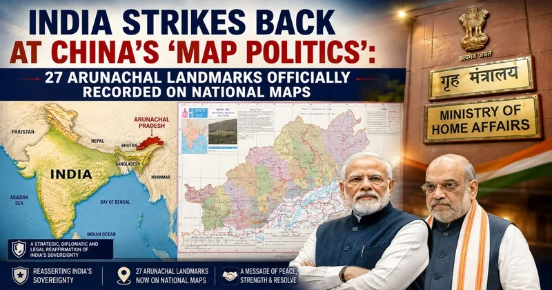
In response to China’s baseless claims over Arunachal Pradesh and its policy of assigning fictitious Chinese names to Indian territories, the Government of India took a historic decision on August 7, 2026. Acting on an order from the Ministry of Home Affairs and in consultation with the Arunachal Pradesh government, the Survey of India has officially recorded 27 significant locations and geographical features of the state on official maps using their standard Indian names. While this may appear to be a mere administrative procedure, its significance is profound from strategic, diplomatic and international legal perspectives.
China’s ‘Rename and Claim’ Policy
For several years, China has periodically released lists of so-called Chinese names for various regions of Arunachal Pradesh. By designating these areas as “Zangnan” or “South Tibet,” Beijing attempts to propagate the narrative that this territory belongs to it. Experts in international strategic affairs view this as China’s strategy of “map politics” or “cartographic warfare.”
China’s policy extends beyond mere renaming. This is considered part of its broader “Three Warfares” doctrine, which seeks to influence international public opinion through legal warfare, psychological warfare and media warfare. The objective is to create an environment where claims can be legitimized in the future by repeatedly asserting them over a territory, marking fictitious names on maps and increasing their usage in official documents.
Bharat has consistently and categorically rejected these claims. The Ministry of External Affairs has clarified on numerous occasions that “Arunachal Pradesh was, is, and will remain an integral and inalienable part of India.” Now, by recording these locations on the official map of the Survey of India, this policy has been given a more institutionalized basis.
Locations Granted Official Recognition
The 27 locations formally recognized by the Survey of India include several areas of profound strategic and historical significance. These include Longju, Maja, Bisa, Thag La, Dzo La, Riza La, Pukur La, Sambho Sarovar, Bara Kundun, Chhota Kundun, Dhan Bari, Preetnagar, Buddhamandir, Jayrampur, Teritnagar, Ramnagar, Sagar, Padma, Jyotinagar, Baisakhi, Chhota Ropuk, Bara Ropuk, Shivaji Nagar, Sunpura and Kamlang Nagar.
In addition to these, two sites holding a special place in Indian military history, Jaswant Garh and the Sher-e-Thapa Memorial, have also been officially recorded. Including these memorials on the official map serves, in a sense, to permanently honor within national records the supreme sacrifice made by the soldiers who laid down their lives while defending India’s borders.
Thag La and the History of 1962
Among these 27 locations, Thag La Pass holds particular significance. It was in this area that the initial military activities of the 1962 India-China war were concentrated. Thag La, the Namka Chu Valley and the Tawang region were among the most critical strategic zones of that conflict. It was from this very area that China launched large-scale military operations during the war. Even today, this region is considered highly sensitive from a strategic standpoint. Consequently, prominently marking this area on official Indian maps conveys a symbolic and strategic message regarding national security.
Jaswantgarh: Where Valour Lives On
Jaswantgarh in Arunachal Pradesh holds a place in the immortal sagas of Indian military history. This memorial stands as a testament to the bravery of Rifleman Jaswant Singh Rawat, a recipient of the Maha Vir Chakra. During the 1962 war, despite having limited resources, he single-handedly engaged the Chinese army for hours, thereby providing Indian troops with invaluable time to regroup. To this day, the Indian Army views this site not merely as a memorial, but as a source of living inspiration.
Similarly, the Sher-e-Thapa Memorial stands as a tribute to the indomitable courage of Indian soldiers. The inclusion of both these sites in official maps signals that India defends its military history and national memories with the same steadfastness with which it guards its borders.
More Than Just a Map: A Document of Sovereignty
In this context, Dr. Rajesh Sharma, a defense expert and retired Indian Air Force officer, states, “Official maps hold immense significance in international law and geopolitics. A nation’s official maps are not merely geographical depictions; they are regarded as authoritative records of the country’s administrative authority, historical claims and constitutional sovereignty. Therefore, the Indian government’s decision is not merely a formality of adding names to a map. It is an institutional response to China’s strategy of attempting to alter actual boundaries by changing names on paper.”
He further added, “India has made it clear that history, geography, and sovereignty are not determined by a list of names issued by another country. Instead, they are defined by a nation’s constitution, its administration, its citizens, its armed forces and its official records.”
The McMahon Line and China’s Opposition
The roots of the India-China border dispute trace back to the 1914 Simla Convention. It was at this conference that representatives from British India, Tibet and China attempted to delineate the border. The boundary line proposed by the then British Indian Foreign Secretary, Sir Henry McMahon, during this process subsequently came to be known as the McMahon Line.
Since gaining independence, India has recognized this line as its legitimate international border. Conversely, China has never formally accepted this line; after establishing control over Tibet, it began laying claim to Arunachal Pradesh. Bharat maintains the clear position that Arunachal Pradesh has always been an integral part of the country, historically, culturally, administratively and constitutionally and that this status is immutable.
China’s ‘Salami Slicing’ Policy
International strategic experts often describe China’s border policy as “Salami Slicing.” This refers to the practice of gradually strengthening one’s claims through small, incremental steps, without engaging in a full-scale war. First, assigning fictitious names; then, citing them in official documents; subsequently, using those names on international platforms; and finally, exerting military pressure in border areas, this is the sequence of actions China has been employing for years.
It is under this strategy that China refers to Arunachal Pradesh as “South Tibet,” occasionally issues so-called “stapled visas” to Indian citizens instead of standard ones and periodically announces fictitious Chinese names for Indian territories. India’s latest move challenges this entire strategy at its very core.
The Growing Importance of ‘Cartographic Sovereignty’
Indeed, in the 21st century, wars are not fought solely with weaponry. Documents, satellite imagery, digital maps, government records and geospatial data have also become vital components of national security. Experts term this concept “Cartographic Sovereignty.” When a nation clearly delineates a territory on its official maps, it is regarded internationally as a significant indicator of its administrative control and constitutional authority. The Indian government’s official mapping of 27 locations in Arunachal Pradesh is part of this broader approach. This move will ensure consistency across future administrative operations, defense planning, infrastructure development, land records and government documentation.
Development, alongside the presence of soldiers, also ensures security at the borders
Over the past decade, India has made it clear that border defense relies not only on military outposts but also on robust infrastructure. Rapid progress is being made on projects in Arunachal Pradesh such as roads, bridges, tunnels, Border Roads Organisation (BRO) initiatives, Advanced Landing Grounds, strategic connectivity routes and the Frontier Highway.
Simultaneously, the Central Government’s ‘Vibrant Villages Programme’ aims to equip border villages with modern amenities to curb migration, strengthen the local economy and ensure a sustained human presence in these frontier regions. Regarding national security, Surendra Mishra, the ‘North and Central Zone Organization Secretary’ of the Akhil Bharatiya Poorva Sainik Seva Parishad- believes that where a population resides, the nation’s presence remains strong.
He states, “When the name of a village, mountain pass, lake, or monument is formally recorded in national archives, the local community’s trust in the administration is strengthened. The tribes of Arunachal Pradesh have been an integral part of Indian cultural traditions for centuries. For the people of these border regions, this decision is not merely about having a name recorded on a map; it symbolizes official recognition of their identity and their homeland.”
A clear message to the international community
Surendra Mishra further adds, “For a long time, China has attempted to create confusion within the international community through the manipulation of maps and the renaming of places. However, this move by India has clarified that actual authority over a region is not established simply by changing names on paper. In the international order, effective administration, constitutional frameworks, local governance, democratic institutions, and sustainable development are considered far more significant foundations. A legislative assembly, an elected government, a judicial system, an administrative apparatus and democratic processes have been functioning in Arunachal Pradesh for decades. It is this reality that further strengthens India’s position.”
A Clear Message: India’s Borders Will Not Change on Paper
The decision to include 27 locations in Arunachal Pradesh in the official maps of the Survey of India effectively symbolizes India’s evolving national security policy. Moving beyond merely registering protests, Bharat is now institutionalizing its historical rights. This decision demonstrates that in the modern era, the defense of sovereignty is not the sole responsibility of soldiers deployed at the border. Official maps, administrative documents, historical records, modern infrastructure, the development of border villages and the confidence of local citizens- collectively, these elements render the nation’s borders impregnable.
With this move, India has sent a clear message: Arunachal Pradesh is not merely an integral part of India in a constitutional sense; its geographical, historical, administrative and cartographic identities are also entirely Indian. Therefore, no matter how many fictitious names China invents or paper-based claims it asserts, India’s borders will remain inviolable as those of a sovereign nation.