Weathermen and scientists tracking extreme climate affecting the country will soon be facilitated with improved satellite data and high-resolution images of the Earth obtained soon from soon to be launched INSAT-3DS. The Indian Space Research Organisation (ISRO) will launch the INSAT-3DS from Sriharikota on February 17, 2024.
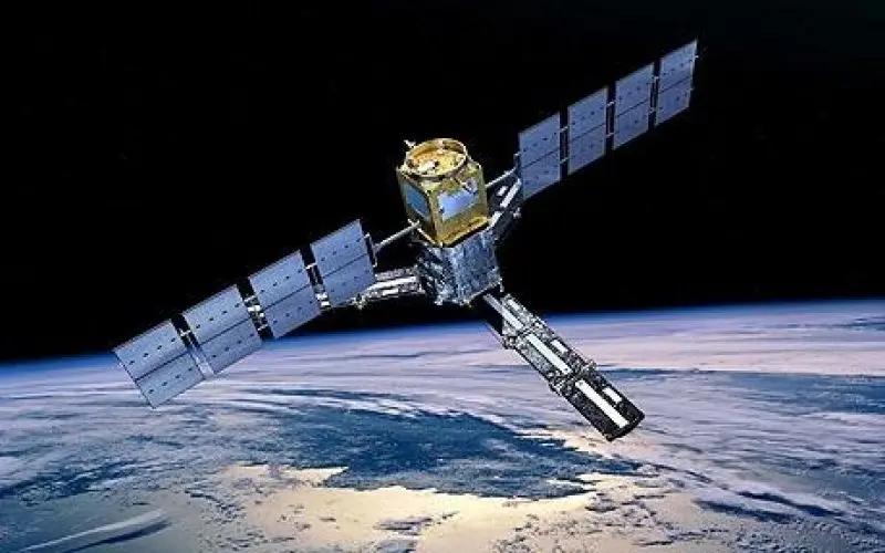
This new facility weighing 2,274kg and funded by the Ministry of Earth Sciences will enable the development of newer satellite products that can be deployed while tracking cyclones, monsoon systems, thunderstorms and other natural disasters. INSAT-3DS shall further the observations of atmosphere, land and oceans. It will be launched onboard a Geosynchronous Satellite Lauch Vehicle (GSLV-F-14).
The INSAT-3DS is a continuation to the Third Generation Meteorological Satellite Series from the geostationary orbit. Presently, the meteorological make extensive use of data generated by satellites like the INSAT-3Dand INSAT-3DR which were launched in 2016, but are still operational.
Many departments of MoES, such as the Indian Meteorological Department, National Centre for Meduim Range Weather forecasting, the India Institute of Tropical Meteorology, the National Institute of Ocean Technology and the Indian National Centre for Ocean Information Services will benefit from the data.
Since 2003, the Indian Meteorological Department (IMD) has been using INSAT data for its operational meteorological purposes. The advent of the satellite-based products brough significant improvements in forecast accuracy, monitoring of the atmosphere and ocean atmosphere and ocean parameters an overall enhanced meteorological service leading to reduction in loss to property, life and livelihoods.
In all INSAT-3DS comprises four payloads, an Imager, a Sounder, a Data Relay Transponder and a satellite aided Search and Rescue Transponder. The multi-spectral imager will generate images of the earth across six wavelength bands aiding visualization of colour dependent atmospheric parameters like water vapour and humidity. The sounder will contribute in generating vertical profiles of the atmosphere and provide information like temperature and humidity.
The Search and Rescue Transponder will be highly instrumental could play a crucial role in enhancing rescue efforts. The instrument can relay distress signals and detect alerts from beacon transmitters from around the globe, helping pertinent search and rescue services.