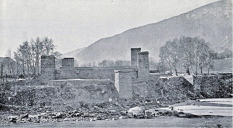
The British withdrawal from India seemed imminent well before World War II wound down. The British economy was practically broken because of the war. Incidents such as the Naval Mutiny of 1946 and the unsustainable costs of keeping India had rendered Independence a foregone conclusion. In such a scenario, one would presume that Gilgit in general and Chitral in particular would have been lost causes for the British; yet, they were not.
The British Conspiracy
The British (as well as the Americans) were aware of the socialist leanings of the Congress leadership at the time, as compared to the fundamentally pro-British and feudal outlook of the to-be Pakistani leadership. The Soviet Union already had a long land border with China, greatly enabling useful involvement in the Communist insurgency waged then by Mao Zedong. A land border with a socialist Bharat would existentially threaten the West’s newly established global order. Another potential factor was that there were preliminary indications that the Gilgit area had uranium deposits—something the British lacked, and the Americans were not willing to provide, and to which the Soviets had access. Chitral, through which the shortest and most convenient route from China to Afghanistan passes, apart from the connectivity it provides between (Soviet) Central Asia and India, became a territory of focus. Having such a nodal location in socialist hands could have greatly compounded the West’s woes. Having the region under Pakistani control was a far safer bet for the West for it had already made a number of convenient logistical and military arrangements with the newly established Pakistan. With these factors in mind, it should not be surprising as to why the British Major William Brown engaged the Gilgit Scouts in the Gilgit Agency to enable Pakistani forces to take over the region. Gilgit occupies a preeminent position in the region, and military action (which was technically treason, but the British chose to reward him with the Order of the British Empire for his acts) by Brown simply could not have been countered in a timely fashion. Interestingly, Chitral’s forces were also prominently engaged by the Pakistanis in concert with Brown. The Mehtar of Chitral, acting as if he were a separate Princely State (which he was not) had illegally acceded to Pakistan at the time of Independence and Chitral was ‘incorporated’ into the North West Frontier Province, now Khyber Pakhtunkhwa. Thus, by force, fraud, and illegality, a section of the erstwhile State of Jammu & Kashmir, and by necessary implication, India, remains under foreign occupation till today.

Post-Independence: Not Forgotten
Even if silence can be considered a marker of assent, it is not that Bharat can be accused of silence on Chitral, post-Independence. In 1956, on the floor of the Lok Sabha, Prime Minister Jawaharlal Nehru asserted twice that Chitral was a part of the erstwhile State of Jammu & Kashmir, and thus India. On May 26, 1956, the Prime Minister stated, “Even since 1876 the Maharaja of Kashmir exercised suzerainty over Chitral. Various internal changes took place subsequently, but the suzerainty of Kashmir continued, and I would add, continues.” While on August 14, 1956, he stated, “The records show that Jammu and Kashmir State exercised suzerainty over Chitral and the principalities in the Gilgit Agency.”. It is not that the name of Chitral was invoked in 1956 owing to the then fresh trauma of the Partition and the challenges which followed immediately. In the 1960 parliamentary speech by VK Krishna Menon on a resolution on the withdrawal of the Kashmir case from the United Nations, he proclaimed, “Therefore, the whole area which is so significant to us, much more than is realised by our countrymen—Baltistan, Gilgit, the whole area of Chitral, the frontiers with China, Soviet Union, and so on—was never a part of Azad Kashmir; those areas were and are within the sovereignty of the Jammu & Kashmir Government.”. Chitral featured last in the annals of our parliamentary proceedings on April 1, 1965, where MP Brajeshwar Prasad argued against joint guarantees of security from the superpowers against China: “A Joint guarantee by Russia and America connotes that India will never resort to force to recover back Aksai Chin, Hunza, Chitral, Gilgit, Nagar, Baltistan, Puniyal and the so-called Azad Kashmir. A Joint guarantee by Russia and America connotes the neutralisation and demilitarisation of India.”. The great political turbulence of the 1960s and 1970s ultimately ensured that Chitral receded from political discourse, but not before the legality of India’s sovereignty over it was affirmed.
Chitral, a historical entrepot between civilisations, warrants its rightful inclusion as a sparkling gem in the diadem of Bharat
Cartographic Coin-Clipping
A connected issue with Chitral is the misrepresented legal boundary of Gilgit. What is today shown as Gilgit’s southern border on Bharat’s maps is not the actual lawful extent of the territory. Currently, maps show Gilgit as extending southwards up till Harban, east of Chilas. However, historical evidence is conclusive in stating that the border ought to extend at least up till Jalkot. As early as 1928, the British Resident in Kashmir gave the extent of Gilgit Agency as follows: “Kashmir State territory, i.e. Gilgit Wazarat, comprising Gilgit Tehsil (including Bunji) with its Niabat of Astor; the political districts, i.e. Hunza, Nagir, Punial, Yasin, Kuh-Gizar, Ishakoman and the republic of Chilas; Un-administered area, i.e. Darel, Tangir, Kandia (Killi), Jalkot, Sazin, Shatial and Harban.”

AH Dani reiterates the above by stating, “Gilgit agency included the autonomous states of Hunza and Nagir, political districts of Ishkoman, Yasin, Punial and Koh-i-Ghizar, and also the subdivision of Chilas and tribal areas of Barel and Tangir. Chilas subdivision extended from the confluence of the Astor river with the Indus to Seo on the right bank and Jalkot on the left bank of the Indus river. Today the western boundary of Chilas district is limited to Shatial bridge on the Indus. Territory beyond is incorporated in the Kohistan district of N.W. Frontier Province.”. Indeed, the areas beyond Harban were separated from the Gilgit Agency only in 1950 by the occupying Pakistanis, who included this area in the Kohistan district. Thus, large parts of erstwhile Kohistan district in Khyber Pakhtunkhwa also form a part of Gilgit, and by implication, Bharat.
Current Events
The fate of the people of Gilgit, Baltistan and Chitral, the so-called Northern Areas, under the Pakistan administration is a sad story of neglect and exploitation. Enough has been said about the lack of basic facilities in these regions (electricity, water, education), a breakdown of earlier arrangements that ensured that uncultivated barren lands did not automatically revert to the Government (as the earlier Khalsa Sarkar laws predicated), and sectarian conflicts brought about by settling mainland Pakistanis and Afghans in that area. The small Kalash population of Chitral (indigenous Hindu) is particularly vulnerable in these anxious times. What is clear both to the Pakistanis and the residents of these areas is that these Northern Areas are not legitimately or accurately a part of the Pakistani State. The recent Tehreek-i-Taliban Pakistan (TTP) attack in Chitral proper is also troubling: as early as 1956, questions were raised in the Lok Sabha as to whether the Pakhtoonistan movement (as it was then known) had designs over Chitral. The people of the region do not have any representation in elected bodies, and they are questioning why they need to pay taxes. Their current status as being administered by Pakistan is deeply inimical to their historical occupation as well, which is international trade.2 Subsidies that they used to receive have been all but withdrawn. The overall situation is exacerbated by the ever increasing knowledge that the quality of life in Indian controlled Jammu & Kashmir is vastly superior to theirs, especially after the abrogation of Article 370 and Section 35A. It is natural if some of the residents of those areas are asking whether they would be better off as Bharatiyas in a nation that is growing economically by the day.
Course Correction
Bharat’s outreach to Central Asia and its increased involvement in Eurasian affairs needs no introduction. India has a number of ambitious transport corridors planned across Eurasia’s landmass. The principal impediment to a number of these projects is the illegal Pakistani occupation of Bharatiya territory south of Central Asia. Within occupied Ladakh, from a purely economic and logistic point of view, Chitral is a fulcrum which allows Bharat to simultaneously and economically engage with multiple historical trade routes cutting across countries and regions.
The inclusion of Chitral in Bharat’s maps, as also extending Gilgit’s boundaries to their full lawful extent, is critical in shaping Bharat’s engagement with adjacent regions. Sight shapes thought, and thought is the foundation of plans; as the opportune moment for the recovery of Bharatiya territories materialises, its importance with regards to India’s Eurasian ambitions has to be a necessary consideration. Further, signalling Bharatiya intent to retake Chitral will lead to a long-term favourable calibration by Central Asian States regarding potential engagement with Bharat. The increased possibility of Bharat exercising its writ over Chitral in the near future may spur Central Asia to begin investing in better economic relations with us. Chitral, a historical entrepot between civilisations, warrants its rightful inclusion as a sparkling gem in the diadem of Bharat, with which Bharat may reinfuse light into ancient trade routes which had once brought all of Eurasia together.


Comments